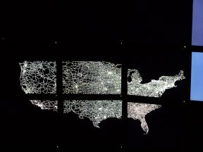
Image (US Highways, 48 States)
Image (US Highways, 50 States)
Image (World, Outline)

Traditional graphics workstations do not have nearly enough pixels to display even small geographic areas at high resolution. For example, if you try and draw a street map of the United States, individual roads will be indistinguishable.
With that in mind, the High-Resolution Visualization and Animation Group is developing a variety of tools for computer cartography.
|
Downloads: Image (US Highways, 48 States) Image (US Highways, 50 States) Image (World, Outline) |
 |